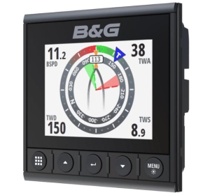
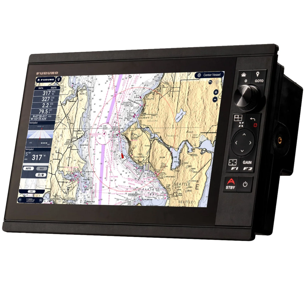
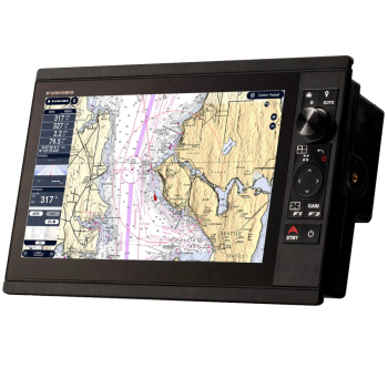
Furuno Multi Function Display NavNet TZT16X
Powerful technology
NavNet TZtouchXL are extra large, all-glass, 16", 22" and 24" multifunction displays with exceptional clarity from every angle, enhancing the functionality and style of your navigation console. You can also opt for hybrid controls on the 10" and 13" displays, making navigation intuitive and easy in all sea conditions, regardless of the size of your vessel. NavNet TZtouchXL give you the flexibility to tailor your navigation console to your needs, with magnetron or solid-state Doppler radar, powerful echo sounders, AIS, autopilot, deep-sea multibeam sonar and much more!
NavNet TZtouchXL works with TZ Maps, the world's most advanced and high-performance electronic marine charts! TZ Maps draws on a global database of high-resolution information to create clear, crisp navigation with a variety of color themes and fishing maps with fully editable color palettes. TZ Maps provide a timeless navigation experience at any magnification. It sounds incredible, and it is: you have to see it to believe it!
Product Benefits
Ultrafast 16", 22" and 24" all-glass displays or 10" and 13" Hybrid Control displays.
New TZ Maps cartography.
Purchase and update maps directly from your multifunction display via an Internet connection.
Compatible NXT and XCLASS radars
Built-in 1kW TruEcho CHIRP™ and dual-channel CW sonar (TZT10X/13X/16X only)
Compatible with DFF3-UHD TruEcho CHIRP™ 2/3/5kW high-power sonar*
Built-in 235 kHz or 455 kHz CHIRP side scan (TZT10X/13X/16X only)
Powerful hexacore processor for fast response.
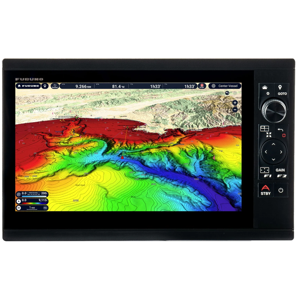
DFF3D compatible deep water multibeam sonar up to 300m depth and 200m side scan, with Personal Bathymetry Generator (PBG).
Add a variety of optional remote controls: MCU-006 and MCU-006H.
Furuno's exclusive Fish-It, Drift-It and Follow-It functions save you time and fuel and increase your fish catches.
A dream machine for fishing enthusiasts
We have raised the bar for sportfishing enthusiasts once again with a series of multifunction displays designed to meet the needs of the avid angler. The NavNet TZtouchXL series is packed with all the features anglers want, including exclusive and never-before-seen features. The TZT10X, TZT13X and TZT16X models feature 1kW TruEcho™ CHIRP or CW sonar
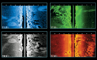 Integrated CHIRP Side Scan
Furuno's CHIRP Side-Scan built-in
with NavNet TZtouchXL scans
from left to right, tracing the shape of the
high definition seabed structure.
CHIRP Side-Scan with a frequency transducer
230 kHz or 445 kHz center reveals the shape of the
fishing targets and structures on both sides
of the vessel. CHIRP Side-Scan is integrated into the
TZT10X/13X/16X models and can be displayed
from any NavNet TZtouchXL on the network.
Find out more with TZ MAPS
With TZ Maps, mariners have control over which cartographic data they want to download, such as extremely large map areas, satellite photos and bathymetric data. Purchase map areas directly from your multifunction display! Custom color gradients and bathymetric overlays create charts of unmatched accuracy and clarity, reproduced in a variety of color themes for an electronic charting experience that goes far beyond any previous premium mapping service.
You can create custom user objects or update mapped user objects, such as buoys, so that as they move from their previous positions on the map, they can be updated on the fly on the system. Custom objects can be shared with other TZ Maps users via the new TimeZero service and can be enabled or disabled in the Layers menu, accessible with a simple swipe up from the bottom of the screen.
Purchasing any TZ MAPS zone also unlocks additional features, such as the powerful AI Routing feature, which intelligently plans routes based on the draft of your vessel, as well as the depths and obstacles shown on your charts. Purchasing any TZ Maps tile also unlocks them in the free TZ iBoat mobile app for mobile devices such as phones or tablets. This gives you a free home planning app that transfers your waypoints and routes directly to your Navnet TZtouchXL. With a free TimeZero account, waypoints and routes can be easily backed up or retrieved from the cloud in just a few clicks, ensuring all the data you’ve worked so hard to build is safe and sound.